Friday, August 13, 2010
Tuesday, June 24, 2008
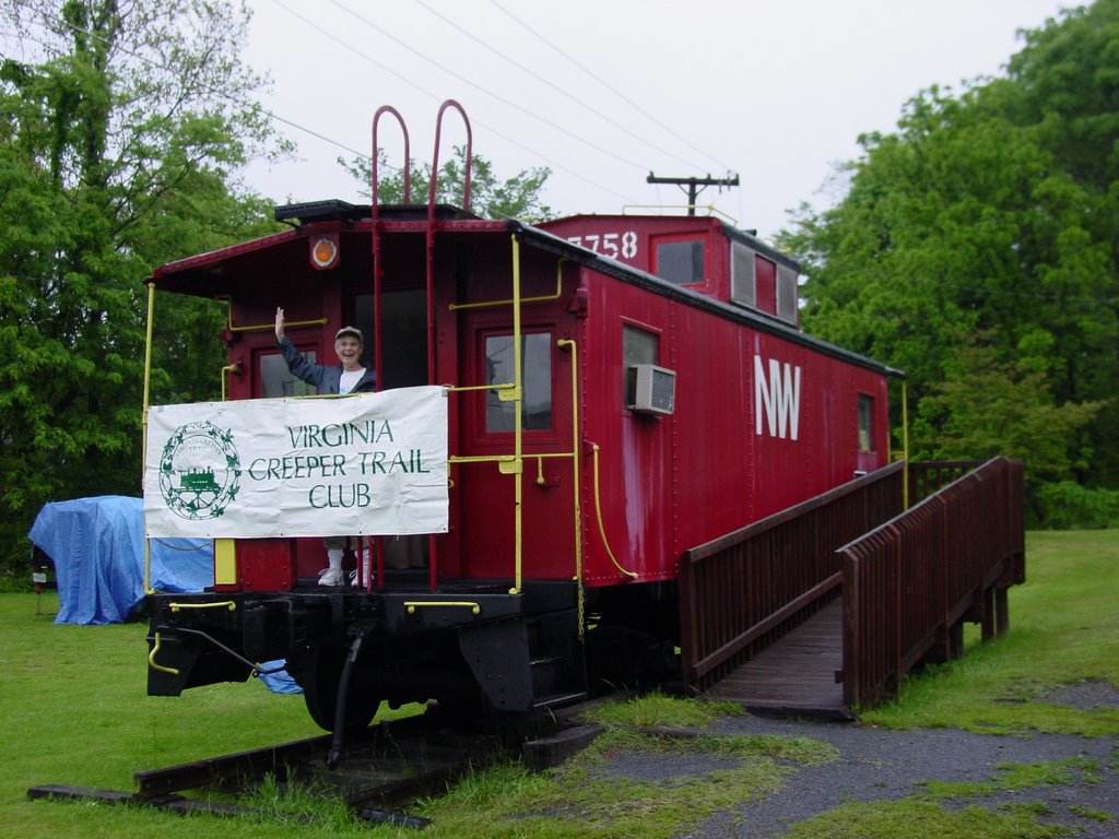
Virginia bikers come to Alvarado
 The Bike Virginia Tour made its way to the Virginia Creeper Trail today and the Virginia Creeper Trail Club was ready. Between 1800 and 2000 cyclists arrived at Alvarado Station, the first around 7:30, only 30 minutes or so after our 20+ volunteers arrived to setup. And they kept coming all morning, pulling in from long climbs up the hills of southwest Virginia, but (most often) with a smile on their face. It was obvious that these riders were having a good time.
The club participated by holding a rest stop around mile 20 of the morning's ride. Some riders were planning to go for a 100 mile day, others chose to make today a light mileage 'recovery' day after some tough climbs yesterday. The Creeper Trail was a popular alternate route for many who had the right tires or had arranged with one of the many bike rental/shuttle companies in Abingdon or Damascus to rent a bike for the day.
Club members, led by our events committee
 chair Wayne Miller, pulled off quite a logistical operation to feed all these hungry riders. Peanut butter sandwiches, bagels, pretzels, homemade cookies, and fruit, as well as lots of water and two types of Gatorade were all available. Club member Dean McCall represented Mountain Sports Ltd in Bristol and set up a bike repair tent that. He looked to be busy all morning repairing all manner of tires, chains, and gear cables. Entertainment was provided by Ashton Blaylock, a very talented local teen guitarist with his eye on Nashville stardom one day (from the sound of his singing and playing today, it's his if he wants it).
Many riders made the short side trip to Abingdon Winery and then on to Damascus where they ate lunch. The routes diverged from there and many found their way back to the tent city in Abingdon via the Creeper Trail.
The Creeper Trail Club was thrilled to have the chance to help introduce our beloved trail to so many new riders today. We hope they enjoyed their brief visit and will come back again to ride the Creeper.
Update: More photos are available from yesterday's rest stop at Alvarado.
Monday, June 23, 2008
Expecting guests
Tomorrow morning will be a big day. We're expecting between 1800 and 2000 bikers to visit Alvarado for a rest stop along the Virginia Creeper Trail as part of the Bike Virginia event. The Creeper Trail Club was invited to participate in this event as a way to highlight the Creeper Trail for the participants who are making the five-day bike tour of southwest Virginia's Crooked Road.
We'll have 25 plus club members out to greet the bikers as they arrive, get them fed and watered, and tell them a bit about the Creeper Trail. We hope that many of them will be intrigued enough to come back and ride the whole trail.
Since this is a tour of the Crooked Road, Virginia's Musical Heritage Trail, we've even booked a local performer, 15 year old Ashton Blaylock, who will entertain and amaze our guests with his musical talent.
We're looking forward to meeting our guests for the day. If you're around tomorrow morning, come on down to Alvarado and give us a hand.
Sunday, May 18, 2008
Trestle Repair

Beginning May 19, repair work will begin on trestles 19 and 20, near mile marker 18, just east of Damascus, on the Forest Service property. Repairs include decking and railings as well as to the structure of the trestle below. Trail riders may experience short delays as they cross these two trestles. For more information, contact the USFS office in Marion.

Monday, May 05, 2008
Going Wild for Wildflowers
'Tis the season for viewing wildflowers along the Creeper. I was near Straight Branch parking area the other day and spotted some Fire Pink and others (my own identification skills are sorely lacking). The club has a number of wildflower experts. In fact, at our first meeting of the year, we had a photo presentation that featured flowers that a member had taken throughout the year along the trail. I'm told that a couple of current "hot spots" along the VCT for seeing flowers are the section from Drowning Ford Rd as you walk back toward Abingdon, and from Straight Branch as you go back toward Damascus.
If you're a wildflower watcher along the trail, please share your observations in the comments section.
If you're a wildflower watcher along the trail, please share your observations in the comments section.
Wednesday, April 23, 2008
Creeper Keepers
Teachers and students at the Abingdon Child Development Center took to the trail yesterday to celebrate Earth Day. They picked up trash along the Abingdon section, near their school, which is heavily used. Even just one month after the club had done a cleanup day, they were able to accumulate a grocery bag full. That shows how much use (and misuse) the trail is getting. It's groups and individuals like these who keep the trail looking good for all of us. Earth Day is past but it's not too late for you to be a Creeper Keeper.
Monday, April 07, 2008
Fun and fungus on the VCT

As we all know, there's more than just hiking, biking, and horseback riding to do on the Creeper Trail. Take a look at this enterprising grandma who wrote about her trip on the trail to hunt for tasty morel mushrooms.
http://peoplepowergranny.blogspot.com/2008/04/its-morel-hunting-time.html
Thursday, March 27, 2008
New Year's in March
The first general membership meeting of 2008 was held last night at the library. We had a good turnout and an excellent presentation by George Kelley of his photographs of wildflowers and other images of the Creeper Trail. George has promised to work on another presentation for later in the year or maybe next year called "Reverse Engineering the Creeper Trail." As a VDOT highway planner for his career (he's now retired), he's uniquely qualified to explain why the trail was constructed as we see it today.

Remember, the club meets the last Wednesday of each month, March-October, almost always at the public library in Abingdon (7:00). Both members and the public are invited to attend. Next month (April 30) our speaker will be Joe Tennis, author and columnist for the Bristol Herald-Courier newspaper.
Remember, the club meets the last Wednesday of each month, March-October, almost always at the public library in Abingdon (7:00). Both members and the public are invited to attend. Next month (April 30) our speaker will be Joe Tennis, author and columnist for the Bristol Herald-Courier newspaper.
26.2 or bust

The 10th Annual Virginia Creeper Trail Marathon, hosted by the State of Franklin Track Club (Johnson City, TN) will be held this Sunday. Unfortunately, if you're thinking of joining in, you're too late to register as they limit the event to 100 runners. However, you can still turn out as a spectator to cheer on the participants. I know they'd really appreciate it. I enjoy being out there watching almost as much as running. The race begins at the Watauga trailhead at 8:00AM. The first couple of miles are on Watauga Road but then it's completely on the Creeper Trail in two out-and-back sections. You can hang out at the Watauga trailhead and see the runners as they pass by at miles 2, 9, 18, and 25 of the course.
Tuesday, March 25, 2008
Flickr group started
I've created a group to share photos of the Creeper Trail on Flickr.com. If you're a Flickr user, you can upload your pictures to share with others.
Sunday, March 02, 2008
The Travel Trade: Marketing the Mountain Empire
Today's Bristol Herald-Courier newspaper has a special section about tourism in Southwest Virginia. There are several articles about the Virginia Creeper Trail, including one entitled "How do you define tourism success? Virginia Creeper Trail". They rank the top destinations in our area and the VCT is #4 (behind Bristol Motor Speedway, South Holston Lake, and Breaks Interstate Park). This is a real honor and a recognition of the impact, both in toursim dollars and local jobs that the trail has on our collective economic development. There's also an intangible, non-monetary benefit to being able to introduce new friends and visitors to the scenic showcase that the Creeper Trail offers. The Herald-Courier is worthy of praise for shining its spotlight on tourism for our area, and for the contribution made by the Virginia Creeper Trail.
I've listed below the others articles in the special section that mention the VCT:
Virginia Creeper Trail: Thousands Bike, Hike, Walk Where Trains Trod
Creeper Trail Tourism Is Golden Ticket for Damascus
Going Downhill Paid Big Dividends for Damascus
Historic Abingdon Still Drawing Tourists to Town
On the Trail of Tourism: Kilgore, Others Working to Establish Mountain Heritage Trail
On the Horizon: What Will Tourists Want: Tourism Pros Offer Insights Into Future Promotion Strategies
Patchwork of Tourism Marketing Options:Like a Quilt, Region's Promoters Piece Together Ways to Entice Tourists to Visit
Saturday, March 01, 2008
Mapping project

I started today on a project to map all the structures (benches, signs, bike racks, etc) along the Creeper Trail. I'm using the Trimble GPS system from the Town of Abingdon's GIS department. They will process the data and produce a layer on the GIS that shows where all of these things are. The GPS is quite advanced, more than the simple Garmin handheld units that I've used in the past. This one is a professional setup with an antenna backpack and data entry unit. Using the bike, I go from one structure to the next, taking notes, and a photo of everything that gets marked.
The impetus to do this is from the Creeper Trail Advisory Board, who makes decisions about new requests for memorial and honorary benches and other structures along the trail. The board is in the process of creating a master plan for new items but before that can happen, we needed a complete inventory of what is already out there. Hence, me with the yellow backpack and antenna getting lots of strange looks by other trail users.
Today I got from the Abingdon trailhead to the crossing at Meade Meadows. It took about an hour and a half. I would have kept going but was running out of daylight. Tomorrow, I hope to make it the rest of the way to Damascus if the weather is nice.
Tuesday, February 26, 2008
Mark Peacock photo
A recent blog post by photographer Mark Peacock featured the "iron bridge" along the Creeper Trail as its subject. A lovely photo of a Creeper Trail icon, it's worth a look. His other work can be found at his online gallery, www.markwpeacock.com.
Sunday, February 03, 2008
Paddlin' the Creeper
We all know that the Creeper Trail is for biking, hiking, and horseback riding. Here's a review of yet another activity, paddling the water that runs alongside the trail, Whitetop Laurel Creek.
Tuesday, November 27, 2007
Doting on Mendota
In 1999, noticing the economic success of the Creeper Trail for Damascus and Washington County, leaders in Bristol, VA decided to get into the act. They formed a plan to purchase and develop another rail bed, this one from Bristol to Mendota, about 12 miles in length. Almost immediately, opposition from nearby landowners brought development to a halt, claiming that when the railroad ceased to operate, the easement reverted to their control. For nearly eight years, their claim has been heard in court and last month the judge ruled against their claim, allowing the trail to go forward. With what can only be described as ironic timing, Bristol now has announced that they have run out of patience and money to develop the trail which they fought for in court for so long. It's not that they don't want the trail and its benefits, they just don't want to pay for them with what it would cost to develop the trail. They're hoping that a nonprofit group will step in to do what they are unwilling to do; put up the money and the effort to finish this project. Tonight's meeting of the city council will feature a discussion and there is popular support being mustered for residents to attend and speak in favor of the trail. Today's Bristol Herald Courier editorialized in favor of keeping the project alive. I agree with their opinion and reasons and will add one more thought. If indeed the people of Bristol support the trail, the city should not shirk its responsibility off onto a small private group like a nonprofit organization. If ever there was a true municipal project, which benefits the common good, this is it. The city started this project and it should be the one to finish it.
Tuesday, November 20, 2007
Southwest Virginia Gets Another Trail
I was pleased to open the paper this morning and see an article about the Cranesnest Trail in Dickenson County. They broke ground yesterday on what will be a 23 mile multiuse trail, similar to the Creeper Trail. There is real excitement about the proliferation of trails in this area. The Salt Trail from Glade Spring to Saltville is well underway. Damascus, of course, has the Appalachian Trail in addition to the Creeper. The Mendota Trail, from Bristol to Mendota, is still delayed in court. Bristol, Mendota, and those in western Washington County are losing out on tourism revenue while the rest of the region has figured out the benefits of having such trails, both for locals to exercise on and for tourists to ride. Congratulations to Dickenson County on the Cranesnest Trail; to Rep. Boucher for locating much of the funding, and to the late Bill Wallace who worked for years to get the project going. The Creeper Trail Club wishes you much success.
Wednesday, November 14, 2007
Paid in full
The Creeper Trail Club recently repaid a $21,000 loan from the Town of Abingdon, who had allocated the funds to underwrite work on the trail through a grant program from the Virginia Department of Conservation and Recreation (DCR). Town Manager Greg Kelly noted the unusual nature of the repayment to the Town in this article from the Washington County News. We're proud of our relationship with the Town and hope that this continues to build as we move forward on future projects.
Monday, November 12, 2007
Appalachian Trekker blogs on the VCT
Check out the Appalachian Treks blog for a nice entry and beautiful photograph of the Creeper Trail.
Wednesday, October 24, 2007
Photo blog
Here's another recent trip made down the VCT with some nice photos of the turning leaves. I especially like the Picassa slideshow and may have to investigate that for the club site.
Tuesday, October 23, 2007
Martin Hassinger
Martin Hassinger, whose family founded and ran the Hassinger Lumber Company in Konnarock, has died. His obituary appears in today's Bristol Herald-Courier. The Virginia Creeper Trail today lies partially on the rail bed built by the company to haul cut timber. The family has asked that memorial gifts in lieu of flowers be made to the Virginia Creeper Trail Club. We are grateful for their generosity and offer our condolences for their loss.
Martin Hassinger
Martin Asa Hassinger, philanthropist, civic leader and businessman, died peacefully on Saturday, Oct. 20, 2007, at Bristol Regional Medical Center.
Mr. Hassinger enjoyed robust good health and died after a brief illness. His life spanned a period of 100 years, during which he gave of himself and his resources in a never-ending effort to improve his community and the lives of the people around him.
Mr. Hassinger was born on June 3, 1907, in the community of Konnarock, Va., a village which his father carved from the virgin wilderness of Southwest Virginia. There he grew up surrounded by a warm and loving family and the sturdy and resourceful people of that region. The Hassinger Lumber Co. built a community church, a school and a store, provided health care for its employees and built a railroad, which is now part of the Virginia Creeper Trail. The company cut more than 400 million feet of timber and became the chief supplier of lumber for the European shipping industry.
Upon completion of his early education in Konnarock, Mr. Hassinger attended Emory & Henry College. At age 18, while at Syracuse University, he was called home to direct the family logging operation and sawmill. He left Syracuse so quickly, he never returned to his room for his books and coat! He ran the business the rest of his life. Even in later years, retirement was never an option.
In 1927, Mr. Hassinger married Caroline Marshall of Johnson City and they made their home in Konnarock. In 1929, as the Depression loomed, he came with his father, Luther Hassinger, and his brother, Bill Hassinger, to Bristol Virginia, where they purchased Bristol Builder's Supply Co., a retail lumber business. He joined the Kiwanis Club of Bristol and served actively for 78 years. In 2005, Kiwanis honored him as the member with the longest period of continuous service in the United States. These were years of remarkable challenge and growth for Mr. Hassinger, as the business flourished and children, Caroline and Ann, were born.
In 1940, Mr. Hassinger entered public service as a member of the Bristol Virginia School Board. During the next 30 years, under his visionary leadership, the City of Bristol enjoyed remarkable growth. When building materials were difficult to obtain after World War II, he often contributed his company's allotment of lumber, making possible the construction of Stonewall Jackson Elementary School and a high school gymnasium, the first of its kind in Southwest Virginia.
In 1948, Mr. Hassinger became a member of the Bristol Virginia City Council and served for 13 years, both as mayor and as a member of the council. His priorities included flood control dams, improving the city's water system and cleaning up Beaver Creek by creating a new sewer system. He acquired the land for the new high school, for Randolph Field, for VanPelt School, for Washington and Lee School and for Sugar Hollow Park. During the 1960s, as other cities experienced turmoil during the integration of schools and other facilities, Mr. Hassinger led other civic leaders in integrating Bristol peacefully and without tension. He served on the Bristol Virginia Welfare Board for 18 years. Through his leadership, Bristol became the first food stamp distributor in Southwest Virginia.
Soon after World War II, Mr. Hassinger expanded the Hassinger Organization, opening Central Warehouse in Bristol, one of the first wholesale building supply businesses in the nation. This was followed in subsequent years by the opening of Dealers Warehouse in Knoxville, Reserve Warehouse in Chattanooga and Hassinger Wholesale in Greensboro. Mr. Hassinger created one of the first employee profit sharing plans in the South. The development of this plan reveals his philosophy of generosity toward employees. A half century later, the profit sharing plan continues to benefit the employees of the company.
One of Mr. Hassinger's most compelling passions was his commitment to State Street United Methodist Church in Bristol. He was instrumental in the construction of the congregation's current building. He created and personally managed the ministers' pension fund for the Holston Methodist Conference. Mr. Hassinger was especially concerned with the needs of young people who could not afford a college education. He gave jobs to dozens of young people who needed an income for college purposes. He provided funds for scholarships for more than 250 young people.
He enjoyed a quality of life seldom experienced at his age. This was in large part due to his caregiver and friend, Robert Roberts. Mr. Roberts made it possible for him to travel, attend business meetings, visit his companies and to never miss a family event. Recently, he traveled to North Carolina to celebrate his 100th birthday, surrounded by his entire family. The family is deeply grateful to Mr. Roberts and his staff, Charles West and Renee Scott, for their excellent care.
Mr. Hassinger was predeceased by his wife of 54 years, Caroline, and his brothers, Glen, William and Robert.
He reserved his warmest and kindest moments for his children and grandchildren, and they devoted themselves to him in return.
Survivors include his two daughters, Caroline Lindsey and her husband Paul of Chapel Hill, N.C., and Ann Smith and her husband Wade of Raleigh, N.C.; six grandchildren, Mari Lindsay, Stephen Lindsay, Timothy Lindsay, Susan Lindsay, Karen Smith Linehan and Robyn Yigit Smith; nine great-grandchildren, Holly Lindsay-Miller, Nicholas Lindsay, Harper Lindsay, Carter Lindsay, Ella Lindsay, Kelsey Linehan, Dylan Linehan, Kenan Yigit and Aslan Yigit; one great-great-granddaughter, Adah Miller; a nephew, William Hassinger of Greensboro; a cousin, Margaret Louise Brown of Gate City; and a brother-in-law, Harrison Marshall of Cary, N.C.
The family will receive friends from 6 until 8 o'clock Tuesday evening, Oct. 23, 2007, at Oakley-Cook Funeral Home. The memorial service will be at 2 o'clock Wednesday afternoon, Oct. 24, 2007, at State Street United Methodist Church, with the Rev. Reed Shell officiating. The committal service and burial in Glenwood Cemetery will be private. Employees of the Hassinger Corp. will serve as honorary pallbearers.
In lieu of flowers, memorial contributions may be sent to Virginia Creeper Trail Club, P.O. Box 2382, Abingdon, VA 24212; or to the Konnarock Community Center, c/o Lucy Huffman, 1028 Laurel Valley Road, Troutdale, VA 34378. Condolences and memories may be shared with the family and viewed by visiting www.oakley-cook.com or faxed to (423) 764-3770.
Mr. Hassinger and his family are in the care of Oakley-Cook Funeral Home, 2223 Volunteer Parkway, Bristol, Tenn.; (423) 764-7123.
Published in the Bristol Herald Courier from 10/22/2007 - 10/23/2007.
Saturday, October 13, 2007
Return of the sled dogs
Last year's inaugural sled dog run will return in January along the VCT. This year's event will be bigger and better with the addition of the Dryland Challenge and Winterfest in Damascus.
Friday, October 12, 2007
Another successful family outing on the VCT
The Creeper Trail is a wonderful outing for families but don't take just my word for it. Here's a recent report from a family from Tennessee.
Thursday, October 04, 2007
Tuesday, October 02, 2007
Sunday, September 30, 2007
Trail reports
Here are a couple of trail reports, fresh from the trail. If you know of other bloggers who have a new trail report, please let me know and I will post a link.
Tangential Thinking
Appalachian Trail Hike and Bike
Tangential Thinking
Appalachian Trail Hike and Bike
Friday, September 21, 2007
Green Cove Celebration
The community of Green Cove, on the Creeper Trail, is adding even more events to the annual O. Winston Link 10K run.
Tuesday, September 18, 2007
Remembering a founder

This Sunday will be a big event on the trail. Dr. David Brillhart of Abingdon was the one who had the original idea to convert the rail bed to a trail, some 25 years ago. He died in February and his family was kind enough to direct those wishing to make memorial gifts to the Creeper Trail Club. Dr. Brillhart's obituary stated that he considered the Creeper Trail his greatest legacy. That's quite a statement, considering the many, many adults and children he treated in his medical practice through the years and the impact his professional skills had on families and the health of the community. Still, he saw the trail as a great part of our region.
On Sunday, we will honor Dr. Brillhart with the dedication of a trailside pavilion at the "Y" park, just behind Elderspirit, about a 1/4 mile from the Abingdon trailhead. The memorial gifts given by his friends and family funded its construction. Club members provided the labor under the direction of Keith Linkous with the Town of Abingdon. The public is invited to attend the dedication, which begins at 5:00. I hope you can join us.
Grassroutes
Tricities.com is the web outlet for television and the Bristol Herald-Courier. They've done a new series on Abingdon, called Grassroutes. One of the articles features the Creeper Trail. It's short but a nice trip diary of one reporter's ride from Abingdon to Damascus.
Wednesday, July 11, 2007
Vandalism
I've been informed that one of the new interpretive signs has been vandalized. Needless to say, I'm beyond disappointed. I'm furious.
The sign in question is near trestle #46 and describes the many trestles and bridges that span the old rail bed that now makes up the Creeper Trail. Vandals used a permanent marker to cover it with graffiti. I've not seen it yet nor a photo, but I'm told that one comment the vandal(s) made on the fiberglass was "This is not graffiti, this is art." Please allow me to disagree with this naive and juvenile display of a need for attention. I have a three year old and he knows better than to color on the walls.
These signs were financed with a generous grant by the Virginia Department of Conservation and Recreation. Each panel and its frame cost several hundred dollars to produce and volunteer labor by club members was used to dig into the ground and mount them in concrete. Now, with one swipe of the pen, a thoughtless and selfish person has defaced one to meet his own need for destruction.
The Forest Service law enforcement has been contacted and will be on the lookout for similar activity. If someone is caught, I will personally go to court to ensure that they are prosecuted to the fullest extent possible. I urge all trail riders to be on the lookout for vandals and to report any suspicious activity.
Sunday, July 01, 2007
The newest rider

We put my three and a half year old son on a bike for the first time today. He took to it like a duck to water and pedaled down the trail about half a mile and back (with many stops). The initial going was slow as it took a bit to understand how the brakes were applied by pedaling backwards but he got it very quickly. I'm a proud papa.
There were lots of people out walking and biking today. We saw lots of pet owners with their dogs and couples walking together. It struck me once again what a fantastic resource the trail is for our community. It's a place to exercise, to socialize, to commune with nature, and, in our case this morning, to watch your kids grow up a bit, right before your eyes.
Tuesday, June 26, 2007
Watauga Crossing Update
 The trail crossing at Watauga Road was the site of a terrible accident back in March. As a result, the town has recently erected new signage on the trail to remind bikers to be careful when crossing this intersection.
Saturday, June 16, 2007

The Caboose in Damascus is a very visible symbol of the railroad origins of the VCT. It sits astride the trail in Damascus Town Park and is greets trail riders, pedestrians, and motorists on Hwy 58 as they enter town.
Unfortunately, the caboose had become weathered and faded to a cloudy pink color. Club members, along with sixth grade students from Asheville's Evergreen Community Charter School recently repainted the caboose, using a special paint, and restored it to its brilliant red color.
The club had hoped to protect the paint job by constructing a cover, similar to the one over the engine at the Abingdon trailhead. A funding solution was identified and the club would have have provided the volunteer labor. However, the Damascus Town Council declined the offer, citing their concern that a cover would detract from being able to really see the caboose. I was disappointed by their decision to not preserve such an important landmark, particularly when the opportunity to do so with no cost to the town may not come along again.
In other caboose news, Abingdon has announced that it has received a caboose that will be placed at Depot Square, on the Creeper Trail Extension. No word on whether they will cover it.
De-mothballification of the blog
I put the blog on the back burner for a while but I'm happy to announce that I'll be updating it more frequently now. This past month, I moved from being a board member of the Virginia Creeper Trail Club to its president. Consequently, I'm now putting in more hours on club business and will try to post those developments here.
Sorry for those of you who are not interested in the club and only the trail, as I will definitely be seeing the trail through the eyes of the club and blogging about it in those terms. However, I think there will be enough info to keep everyone happy.
The new board and officers will be meeting on June 23rd for the first time. We have a lot to discuss. I've already filled my dry-erase board with ideas for them to consider and I hope there will be much to report in the near future about additional projects and club development.
For now, I'll end with a plea to readers of this blog who also manage websites. Would you mind posting a link to the club (www.vacreepertrail.org) on your site? I'm trying to increase our Google PageRank and increase the visibility of the site. There's a lot of good things happening in the club and the increased visibility could really help them get moving. Thanks!
Wednesday, February 21, 2007
Temporary gates between Watauga/Alvarado
 Two gates across the trail are temporary and I'm told should be removed by the end of this month. The area in question is near trestles 7 and 8, on the section between Watauga and Alvarado. The gates are a temporary solution to allow cattle to cross the trail to their water source. This will continue until the Town of Abingdon completes the improvements underneath the two trestles to allow the cattle to cross without disturbing the trail. The gates will remain but will be closed (opening the trail) when the improvements are done. In the meantime, trail users should please close and latch the gates with the chain as they pass through.
Monday, February 19, 2007
Interpretive signs away
The interpretive signs along the trail will soon be a reality. It's been a longer process than I expected, but the proofs are going in the mail today to Pannier, the manufacturer. In 6-8 weeks, the signs and frames will be delivered and then it's just a matter of finding good weather to put them out.
2/21 Update: I spoke with Pannier today and it's looking more like 3-4 weeks instead of 6-8.
2/21 Update: I spoke with Pannier today and it's looking more like 3-4 weeks instead of 6-8.
Wednesday, February 07, 2007
In Memorium: Dr. Dave Brillhart

One of the founders of the Virginia Creeper Trail, Dr. David Brillhart, died yesterday. Below is his obituary as listed in the Bristol Herald-Courier (italics mine).
ABINGDON – Dr. David M. Brillhart died peacefully at his home early Wednesday morning, Feb. 7, 2007.
Dr. Brillhart was born on Nov. 14, 1925, in Troutville, Va., the son of Arlie Raphael and Lelia Dove Brillhart. After high school, he attended VPI until he was drafted into the service during World War II, where he served in the European Theater as an infantry scout. After the war, he attended Bridgewater College, from which he graduated in 1948. He then entered the Medical College of Virginia, where he met his future wife, Charlotte Long, whom he married on Oct. 14, 1949. After being in Abingdon as a medical student, David decided to come to Abingdon to practice medicine as a general practitioner after graduation. Starting in the era of home calls, Dr. Brillhart had a medical career spanning over 35 years, during which time he delivered hundreds of babies and, together with Ed Hill, served as team physician for the Abingdon High School football team. Although Dr. Brillhart was extremely busy with his medical practice, being on call at the emergency room, and making rounds at the hospital and nursing homes, he always found time to spend with his family. He was always a devoted and loving husband and father. After retiring in 1990, Dr. Brillhart continued to pursue his lifelong hobbies of woodworking, photography, painting, music and hiking. In the 1970s, he and fellow planning commission member, Dr. French Moore Jr., developed and pursued the idea of transforming the about-to-be-abandoned Norfolk and Western rail line between Abingdon and Whitetop Station into a recreational trail, which eventually became the Virginia Creeper Trail. Dr. Brillhart believed that the Creeper Trail might be his most lasting legacy. Dr. Brillhart was raised in the Brethren Church, but became a member of Sinking Spring Presbyterian Church after coming to Abingdon, where he was a choir member for many years.
Survivors include his wife of 57 years, Charlotte Brillhart of Abingdon; one daughter, Anne Meinrath of Woodlands, Texas; one son, Mike Brillhart of Abingdon; four grandchildren, Lesley Icenogle, David Meinrath, Maggie Brillhart and Sallie Brillhart; and several nieces and nephews.
A celebration of the life of Dr. David M. Brillhart will be conducted at 3 p.m. on Friday, Feb. 9, 2007, at the Sinking Spring Presbyterian Church, with the Rev. Dr. Robert N. Lominack Jr. and the Rev. Robert Tolar Jr. officiating. The family will receive friends in the parlor of the Sinking Spring Presbyterian Church immediately following the service. Private interment will be conducted on Saturday, Feb. 10, 2007, in Botetourt County, Va.
In lieu of flowers, the family asks that memorial contributions be made to the Virginia Creeper Trail Club, P.O. Box 2382, Abingdon, VA 24212; or to the Arts Depot, 314 Depot Square, Abingdon, VA 24210 in memory of Dr. David M. Brillhart. Online condolences may be submitted to the family of Dr. Brillhart at www.frostfuneralhome.com.
Frost Funeral Home, 250 E. Main St., Abingdon, (276) 628-2131, is serving the family of Dr. David M. Brillhart.
Saturday, January 27, 2007
Sled dogs on the Creeper Trail
 Siberian Husky Assist , a local dog rescue group, held a Memorial Serum Run on the Virginia Creeper Trail today, to commemorate the historic 1925 event in Alaska. "Cruiser" who ran the 2006 Iditarod was part of the sled team relay. The event got some media coverage.
Thursday, December 28, 2006
New fencing for cattle on Smith farm section
Reported by club member Anne Maio:
Just in case you haven't been on the VCT between Watauga and Trestle 8 this week, the new fencing is almost complete. Two contractors have been installing wooden posts and metal fencing that looks to have about 5x7" rectangles (so it's not just straight wire fencing). There is also a new gate (Actually, it looks like a used gate.) a little way before you get to the sawmill and Trestle 7, coming from Watauga.
Wednesday, December 27, 2006
When does the rhododendron bloom along the VCT?

I had an opportunity to receive this question this week from an inquiry to the club website. I forwarded it on to our resident flower expert, Eleanor, who offers this reply:
Mothers' Day till the end of May is the time for Rhododendron catawba (lavendar to pink) to bloom in Damascus and not so high areas of the Appalachian Trail. If you want to see catawba in mass go to Grayson Highlands State Park between June 10 and 20, park at Massey Gap and walk up the Rhododendron Trail to the AT -- go south to the Crest Trail (a horse trail) and be impressed all along the walk.
July 4 is usually the peak for Rhododendron maximum (white blossoms) to bloom along the VCT, Straight Branch Road (US58 east of Damascus) and the Appalachian Trail. Some Julys there are more white blossoms than during other Julys.
When you take the shuttle to White Top Station and look up to the open field of White Top Mountain, you can drive up to that open field and find photogenic flowers beside the switchback road and on the AT going north or south from early spring to late fall.
Saturday, November 11, 2006
Interpretive trail signs being produced
Right now I'm working on a project for the Creeper Trail Club. We received a grant from DCR to do a number of trail improvements, including the benches/kiosks and the new trail maps. The final element is to design and produce a series of signs along the trail to interpret the natural and historical features for trail users. I inherited the project after much work had already been done by others. The text for the signs has been written by Ed Davis and Ed Morgan, authors of The Virginia Creeper Trail Companion. I'm serving as the project manager, mostly by gathering images to go with the text and working with a local graphic designer, Holly Horton, to make them look spectacular. The signs themselves will be produced by Pannier, who also did the trail maps that look so nice. We should be ready to send them off for manufacturing in the next month. If the weather holds, the trail maintenance crew and I will be installing them sometime after the first of the year.
Wednesday, September 20, 2006
Green Cove Station

It's been a while since I posted. Sorry about that but now that the busy-ness of summer is over, I hope to get back to the blog a bit more regularly.
Day before yesterday, I got the bug to get outside and made a somewhat impromptu trip up to Green Cove Station. I say "impromtu" because when you travel with a three year old and an eight month old, no travel happens without some degree of planning. I packed a picnic lunch and we made the drive in about 45 minutes up from Abingdon.
When we got there, we were greeted by Skip Blackburn, the volunter who operates the station for the US Forest Service. It's the last original train station on the Creeper Trail (White Top Station was restored about four years ago). Skip has made the station into a must-stop destination for trail riders. It's a general store with lots of snacks and supplies. He also has many t-shirts and souvineers on consignment from the Friends of Mount Rogers. However, the best part of the station is the museum in the back two rooms. The centerpiece of the permanent exhibit are the original photographs by O. Winston Link, including "Maude Bows to the Virginia Creeper", which Mr. Link donated. Right now, there's a temporary exhibit by staff photographers of the Roanoke Times newspaper who went out to four of the original locations from Mr. Link's photos and re-shot them. They're in color, contrasting with the original B&W beauty and in some cases, even feature some of the same models.
I had fun talking to Skip and looking at the photos. My son enjoyed the playground at the Green Cove Community Center next door. All the time, a steady stream of visitors came up and down the trail, many stopping at the station for a break.
Thursday, June 29, 2006
Club meeting updates
Highlights from last night's meeting of the Creeper Trail Club:
- Green Cove Station is featured on the cover of the new edition of Images of Washington County, Virgnia, a business and promotional magazine from the chamber of commerce. Unfortunately, the website doesn't yet seem to be updated with the new issue. The article is titled, "A Link to the Past".
- The Town of Abingdon has employed Steve Hudson as a "Trail Ambassador" to help bikers and trail users on the Abingdon/Damascus section. He rides the trail four days a week, picking up trash, answering questions, and fixing flats for bikers while keeping track of the need for trail maintenance like downed trees. When he sees something needing attention beyond what he can give on the bike, he calls in the crew from Parks and Rec to follow up. He usually parks his car at the Alvarado station, riding first to Abingdon and back in the morning, and then toward Damascus in the afternoon.
- Budget cuts from the Forest Service will limit the operating days of the Green Cove Station to four days a week (Friday through Monday), beginning in July. With all that Skip Blackburn and the station provide to trail users, this is a big disappointment.
- The towns of Abingdon and Damascus are working on a joint resolution to codify the official rules of the trail. This is partially in response to adjacent landowner concerns and was also prompted by the club's initiative to post the "rules of the trail" on some new trail maps that will soon be unveiled.
- The recent fundraiser for the O. Winston Link memorial at Green Cove (to be dedicated October 7) was successful in bringing the funds balance to around $4000. That means they are about halfway to the amount needed. If you know of an individual or business who would be interested in completing this campaign, I'm sure they'd be glad to hear from you.
Monday, June 26, 2006
A Creeper Trail Wedding
I've been meaning to post this for some time but keep forgetting. It seems that Rick Boucher (D-VA), our representative to Congress from the ninth district recently got married. That in itself isn't so remarkable for purposes of this blog. However, he and his bride, Amy Hauslohner, chose the Virginia Creeper Trail in Damascus as the spot for their ceremony. You can read more about it from Boucher's own website. The choice of setting is no surprise since Rep. Boucher has been a longtime friend of the trail and has assisted with its development for years. Congratulations, Rick and Amy.
Sunday, June 18, 2006
Gone fishing...for railroad spikes
I went fly fishing yesterday just off the trail. As I've said before, the Creeper Trail runs by some of the finest trout water (Whitetop Laurel) in all of Virginia. It provides terriffic access to miles of water, some stocked and some reserved for single-hook artificial (flies).
Yesterday, I was happy to introduce an old college friend with whom I've recently reconnected, to the water along the Creeper. We started in the special regulation section between Creek Junction and above Taylor's Valley but ended the day down by the bridge in Taylor's Valley itself.
Rob is a much better fisherman than I am and caught many more, but I did mange to have a good day by my standards (half a dozen or so- we practice catch and release so I don't know for sure how many). The going was slow at first with the only action on droppers. I caught my first fish on a Tellico Nymph. The hatch was pretty varied throughout the afternoon. I tried several different patterns and had luck with Blue Winged Olives and a Light Cahill as well. As the light started to fade, the hatch came off heavy with a cloud of bugs, mostly Yellow Sallies but the fish were so active, I was getting hits even on an elk-hair caddis stimulator pattern. As we wound down the day at the bridge, we were joined by a vacationing dad and his two kids who wanted to see a fish. Rob promptly pulled one out and let them touch it, much to the delight of the three year old boy who pronounced it "slimey".
The real catch was earlier in the day when Rob climbed up the bank and found an old railroad spike, surely left over from the days of the Abingdon Branch. It was coated with oxidation but still solidly intact. He knew of my interest in trail history and was kind enough to share it with me. I told him about the recent auction (see previous post) where one of the items was a collection of "date nails". These are smaller spikes with a two digit year imprinted on the head used by the railroad to mark when a section of rail was put down. As we were walking to the next fishing hole, Rob spotted an old wooden railroad tie, that had washed downstream and went to look at it. Lo and behold, it had a date nail from 1917, sticking right up and easily removable! I'm thrilled to now be the keeper of both spikes at his kindness.
Friday, June 16, 2006
Yes, I'm Link. No, not that Link.

On October 7, at Green Cove Station, a memorial monument, commemorating the 50th anniversary of O. Winston Link's famous photo, "Maude Bows to the Virginia Creeper", will be unveiled.
Last night, at Abingdon's Martha Washington Inn, the group responsible for the monument held an auction and dinner fundraiser and I was pleased to be in attendance. Food, live music, and good company all contributed to a lovely evening out for my wife and I.
Two pieces were the highlights of the auction. The first, a framed poster of OWL's "Maude" print had been signed by the three persons in the photo still living, and is sure to be a one-of-a-kind collector's item. The second was a metal sign, weighing approximately 50 lbs. from along the Abingdon Branch of the railway (today's Creeper Trail), reading "Do Not Tresspass Over Bridge" (or something like that) from near Watauga Station. Accompanying the sign was a framed poster of the print that O. Winston Link made of the train just as it passed the bridge. The sign is clearly visible in the photo. I was very interested in it but so were many others and it went for nearly $500. Don't feel bad for me though, I won the auction for a gift basket from the Virginia Creeper Trail Club which included club merchandise and a lifetime membership. I don't know how much the auction raised but if you are interested in contributing to the monument, you can contact Chris Johnson, Abingdon's Director of Parks and Recreation, who is the chair of the committee.
In case anyone is wondering, yes, my real name is Link. However, I'm no relation (that I know of) to Mr. O. Winston Link. I'm named for my mom's family who are from Humphreys Co., Tennessee. O.W.L. was from New York and I think the Link family reunion for his family is held in West Virginia. Despite our mutual interest in the Creeper Trail/Abingdon Branch and our shared name (his last, my first), we're not related, though I'd love to find a connection. Any geneaologists out there?
Saturday, May 20, 2006
Damascus Trail Days 2006
This morning I went down to Damascus for the annual Trail Days celebration. It attracts people from neighboring states as well as from afar. I met one family who had traveled from Delaware. Of course, the real attraction is for hikers on the Appalachian Trail who are passing through from Springer Mountain, GA to Mt. Kathadin, Maine. The Creeper Trail actually crosses the AT several times on its descent in to Damascus and so the festival attracts people who use both trails.
Those who camped out in tent city last night had a wet experience as we had a massive thunderstorm for most of the night. When I went though the vendor section first thing this morning, a few of their booth canopies had suffered wind and water damage, collapsing under the strain. However, most people seemed to be in a good mood this morning, despite the water and cooler temperatures.
I was working the morning shift for the Creeper Trail Club booth, which was actually the caboose in Damascus, which normally serves as a visitor center. We sold Creeper Trail merchandise and answered questions about the trail and the festival. I worked the 9-noon shift and then met a friend for some fishing, but that's for another post.
Thursday, May 18, 2006
Trail Repair Update
Please let folks know that we plan to repair the railings on trestle 38
above creek junction next week. The trail will not be closed, but ALL visitors will need to cross the trestle on foot and push their bikes or walk their horses.
Sara Schell
Recreation Program Manager
Mount Rogers National Recreation Area
George Washington & Jefferson National Forest
276-783-5196
800-628-7202
Saturday, May 13, 2006
Mt. Rogers Naturalist Rally
The 32nd annual Mt. Rogers Naturalist Rally was held today at Konnarock Community Center. Lots of different options were available for the morning and afternoon sessions. We had the kids so our choices were a bit limited, particularly because we didn't arrive until mid-morning. Even though we missed the morning trips, which left at 8AM, we had fun at the community center. Our two year old played on the playground and we had a picnic lunch together. Lots of fun.
At 1:00 we joined the crowd making selections for which outing to go on for the afternoon. We had intended to go on the salamander hunt but after asking about the terrain, we decided it was probably to much with the kids. Fortunately, we got in on an interpretive walk down the Creeper Trail by Ed Morgan. Ed literally wrote the book (along with Ed Davis of Emory and Henry College) on the Creeper Trail. It's now in its third printing and is the definitive guide to the trail. In addition, Ed serves on the Abingdon Town Council, which has oversight and management of a portion of the trail so his interest in the trail is professional as well as personal.
Parking at Creek Junction, we were joined by one other rally participant, Mary, who lives in Seven Mile Ford. I carried the two year old in the backpack and my wife pushed the baby in the jogger stroller. Ed led us down the trail about two miles and back, telling stories and tales about the trail. We learned about the warbler that flourished in the transitional forest that regrew after extensive logging (ending around 1930). One in every three trees harvested from this forest in the early 1900s was a chestnut. This was before the aphid from China came over and caused such damage.
The main speaker for the rally last night was a scientist who is working on a new aphid and disease resistent variety of chestnut to be reintroduced. Ed talked about the stream health of Whitetop Laurel running alongside the trail and how the take limits on trout have made this one of the best fishing streams in Virginia.
We passed many fishermen along the way as well as a steady stream of bikers. One biker I recognized as he approached. It was Lawrence Dye, on the return portion of his daily ride up to the top and back.
After returning to Creek Junction, the group dispersed but we stayed around for a while. Our son enjoyed throwing rocks in the stream and we took some photos. I also talked to a fisherman who was down from New Hampshire on an annual trip to fish with some friends.
All in all, it was a great day, outside with the family on the Creeper Trail.
Saturday, April 29, 2006
Abingdon to Damascus


I joined a group riding this morning from Abingdon. I only went to Damascus but most of the rest of the crew were going all the way to Whitetop and back. Whew!
Harold Smith of Coastal Cyclists of South Carolina organized a trip up for some of his club members. He was here last year for Lawrence Dye's 100,000th mile celebration and wanted to come back. The group left Abingdon at 7:30, met up with others in Damascus at 9:00 and were headed to the top. They left me in the dust pretty quickly and I joined other members of the VCTC on my section to Damascus. Chris Sullivan, club president, Lawrence Dye, and Randy McMichael of Buchannan Co. (a friend of Lawrence's and frequent trail rider), and I rode together to Damascus.
It was a very beautiful morning, though the early start was a bit chilly. It warmed up as we rode and talked. Lawrence knows so much about the trail that he was kind enough to give me a little history lesson. Between Alvarado and Damascus, just beyond Rt. 858, the trail parallels the South Fork of the Holston, carrying runoff from the Mt. Rogers area. Lawrence pointed out where many years ago VDOT had diverted the river to complete the road. It clearly used to be on the other side of what is now Hwy. 58. That sort of project would never pass muster today for obvious environmental reasons.
Monday, April 03, 2006
Teenage wasteland
I was out on the trail yesterday for a few hours of fishing. As I often do, I went to the special regulation (artificial lures only, 12" minimum length) section between Taylor's Valley and Creek Junction. The water in the stream was exceptionally clear, which may have had something to do with the fact that the fishing was terrible. After a while, I just kind of gave up and sat streamside watching and listening to the water and the woods. The silence was intermittent, however, since the trail was in pretty heavy use by some large groups of teenagers. I didn't ask but wondered if an entire church youth group was riding the trail together. They dropped their bikes and had a great time climbing on the boulders nearby my fishing spot. My feelings were mixed as I was a little miffed that they would choose "my" quiet spot to stop. But then I quickly came to my senses and realized what a great thing it was that somebody had chosen to bring these kids out on the trail. They were clearly having a blast riding and bouldering, and there wasn't a video game in sight. It was an affirmation of a book I recently read, "The Geography of Childhood".
Saturday, April 01, 2006
Mailbag
On Apr 1, 2006, at 8:50 AM, Mike wrote:
Hey Link,
1st question - I'm clueless about blogging. How do you post a question? I tried "blog this", but it didn't show up.
Real question - Is the trail crowded on weekends in early May?
Thanks!
***********
Mike,
You did just the right thing to ask a question by posting a comment. "Blog This" is a feature of the Blogger.com website that other bloggers can use to link to somebody's page that they want to write about. It's easier for them than copying a long URL and building a hyperlink manually from their own blog.
As for the trail in May, I wouldn't use the word crowded but with the advent of warmer weather, May is when you will see an increase of folks on the trail from the colder months. You're still well before the summer rush though so I'd say you'll have no issues with the number of people unless you're just looking for complete solitude, in which case winter is your only real option. You tend to see more folks the closer you get to Damascus and Abingdon. The upper portion of the trail near Whitetop and Green Cove Station down to Creek Junction and Taylor's Valley is usually pretty light unless you get caught up in a group coming down from the top together. If that happens, just pull over for a few minutes and soak in the surroundings for a few minutes while they pass you by.
Enjoy,
Link
Friday, March 31, 2006
Blogging is addictive
I've started another blog. It's not like I'm just posting every day on this one and had to find something else to write about. Rather, I wanted a record of the actions I take for our vegetable garden this year so I can come back to it in coming years and use my notes to improve on the harvest. If anyone is interested in reading, you can get there by clicking on my profile at the left and choosing the link to "What's Going On In My Backyard" down at the bottom. Or you can cut and past this link into your browser and get there directly.
http://whatsgoingoninmybackyard.blogspot.com/
Any other Zone 6b gardeners out there? Any nearby? I'm a newbie at the vegetable garden thing and could use any advice you can spare. Please be kind when you spot all that I'm no doubt doing wrong.
http://whatsgoingoninmybackyard.blogspot.com/
Any other Zone 6b gardeners out there? Any nearby? I'm a newbie at the vegetable garden thing and could use any advice you can spare. Please be kind when you spot all that I'm no doubt doing wrong.
Thursday, March 30, 2006
Updates from the club meeting
Last night was the first membership meeting of the year for the Virginia Creeper Trail Club. No speaker last night but a good bit of business from the winter months was discussed.
One of the coolest things was the announcement that the new maps for the trail kiosks are being finalized for printing. They will be made out of fiberglass and hung in vandal-proof frames on the new structures that have recently been built at points along the trail. Both the map project and the kiosks were funded by grants from DCR. I think trail users will be VERY excited to see the maps as they are really well done and will be a great resource for people biking, hiking and riding the trail. In addition to using them on the kiosks, there was some discussion that the club print and sell posters of the new maps, which I think is a great idea and would be a great souvineer, especially for those who come from outside the region to complete the entire length from Whitetop to Abingdon.
At the meeting, I also spoke with Lawrence Dye who has biked another 6,000 trail miles since being honored a few months back for his 100,000th mile on the Creeper Trail. Absolutely amazing.
Chris Johnson from the Town of Abingdon reported that, with a few minor fixes excepted, the trail re-surfacing has been completed. This is great news.
I reported to the group on some website developments to the club site as well as a new communication resource for members and folks interested in the trail. It's an email listserv on the Yahoo Groups site. The link to sign up is on the club website (www.vacreepertrail.org) or you can go there directly at
http://groups.yahoo.com/group/virginiacreepertrailclub/?yguid=98264518
Thursday, March 09, 2006
Mailbag
On Mar 8, 2006, at 9:13 PM, rick wrote:
Question: is a recumbent bicycle suitable on the VCT, or is it best
to go with a mountain bike??
--
Posted by rick to Virginia Creeper Trail at 3/08/2006 09:13:47 PM
Well Rick,
I've never ridden a recumbent bike (other than a stationary one at
the gym) so I'm perhaps not the best to answer this from firsthand
knowledge. You might want to call one of the local bike shops like
the Virginia Creeper Bike Shop here in Abingdon (276-676-2552) if you
want to speak to someone with firsthand experience. I can tell you,
however, that the trail is pretty smooth and has a cinder base in
most places. It's certainly more boulevard than single-track and I
know that many upright bikes of non-mountain variety are on it every
day. Good luck and enjoy the trail
Wednesday, March 01, 2006
Alvarado to Holston
My friends Jeremy and Sara were in town from Texas and wanted to see the trail. I took them down to Alvarado and we walked to the trestle over the Holston Lake. It was about 55 degrees and sunny. We took our time and enjoyed spotting some birds and listening to the river as it swept by along that part of the trail.
Being winter, the water level was way down so it looked much different with the exposed banks than the last time I was there this fall. The Middle and South forks of the Holston have their confluence at the trestle (the longest one on the VCT) and it's beautiful to look down on the swirling water. The Middle Fork carries much more sediment than the South Fork which comes from the mountains and doesn't pass through as much farmland and other developed land as the Middle Fork. Looking down, the "dirty" water and the clear mixed together and what started as a clear line dividing the two was quickly swirled into one.
We had a great time just sitting in the sun and talking for a while. Only one other person passed during our entire time on the trail. He had a garden-type tool and was going "plug hunting" down on the exposed banks (fishing plugs). He said he gathered several hundred last year.
We ended up back at the general store (Old Alvarado Station) and I was surprised to learn that it is under new management. The couple that had bought it just a couple of years ago (maybe less?) has sold out and opened a new restaurant in Damascus. According to the lady at the counter, the new owner is a writer and has some connection to the movie "Capote". She's going to be at the Academy Awards this Sunday so I'm curious to learn who from Hollywood has a local connection to Alvarado.
Sunday, February 12, 2006
Sunday, January 08, 2006
Walking Alvarado
Today was another opportunity to get the family out on the trail, little red wagon and all. We decided late Sunday to go down to Alvarado. One of the nice things about the trail is that you can access it at so many different places that you don't get bored going from the same spot all the time. Anyway, we parked at Old Alvarado Station and walked/pulled my son in the wagon toward Abingdon. We didn't go too far. A pregnant wife and a toddler aren't exactly the formula for a long distance walk. On the way back, we saw a group that had left from Alvarado and biked nearly to Abingdon as well as several other walkers. From the evidence on the trail, some horseback riders had recently been through as well.
Monday, January 02, 2006
Creeper Trail now on Google Earth
I created a Google Earth listing for the Virginia Creeper Trail today. If you're a user of the free Google Earth application, go to the link in the sidebar to download it from the announcement page in the forums. If you need to download the Google Earth application itself, the link for that is in the sidebar as well.
Sunday, January 01, 2006
Happy New Year!
New Year's day was a balmy 55 degrees in Abingdon so we had to get outside. My wife is pregnant and due just about any time so our walk from the Abingdon trailhead was decidedly slower and shorter than usual. Our toddler came along in his little red wagon, a Christmas gift from his grandparents. We strolled down to the park area behind the almost-finished Elderspirit development (www.elderspirit.net) where he ran around while mom rested at the picnic tables. We noted the new bench and bulletin board at the trailhead put up by the construction crew of the Creeper Trail Club (www.vacreepertrail.org). They look great and sure do add a lot. Trail users owe a big thank you to Bob Horsch and his construction crew for their efforts.
Sunday, December 18, 2005
List of Geocaches on the Virginia Creeper Trail
Those wanting to make a cache run for multiple caches could do a lot worse than biking down the Virginia Creeper Trail. At present, by my count, there are 22 caches accessible from the trail. I haven't found them all but here is the list. It begins at the top (Whitetop) and descends through Damascus to Abingdon. Each cache name is followed by its corresponding waypoint code for use on the geocaching.com site. Enjoy and please let me know if you make the entire run.
This list is also available (you must be logged in) in downloadable form at:
http://www.geocaching.com/bookmarks/view.aspx?guid=51289ba9-8029-4c69-86e3-c505214d2bd8
Green Cove- GCJFEC
Creek Junction Cache- GCJJNP
Whitetop Laurel Creek- GCK96E
Creeper Cache- GCEAA
In the Dog House- GCHEKD
Hobo's Island- GCHXQ9
Slippery When Wet- GCHZ38
Mossy Rock- GCHZ3C
Beech Grove Trail Cache- GCR5HH
Appalachian Trail Brick (virtual cache in Damascus)- GCH6NT
Deep Gap Shelter (virtual cache in Damascus)- GCH6NY
Find F.R.E.D. #2 (night cache only)- GCQ4MJ
Little Red Cache #1- GCA2B4
Log Cache- GCADC1
Alvarado Cache- GC3D4E
Stumpjumper's Stump- GCADFA
Trailside 1- GCGTXT
The Brown Box- GCR07Y
Drip... Drip...- GCNR7J
Creeping Around Abingdon...Again!- GCQTVR
Holey Apple Cache- GCQ415
Blue Turquoise Stinger (multi cache)- GCK70A
More caches are added all the time. If you find one that's not on the list, please let me know.
Friday, December 02, 2005
A lost November
As you can see, I was a little slow on blogging in the month of November. That's not to say that I was ignoring the trail, just the blog. In fact, my online efforts for the VCT have expanded a bit from my own blog to becoming the webmaster for the Virginia Creeper Trail Club. So, THAT'S what I've been doing in November. I'm planning to continue this blog as a personal project although I may try to expand the VCTC site to include a blog since they get far more web traffic than this meager blogspot page. Anyway, if you're so inclined, please check out www.vacreepertrail.org and let me know what you think.
Monday, October 31, 2005
Fishing Taylor's Valley
I got out yesterday afternoon for some fly fishing on Whitetop Laurel which runs beside the VCT for a good portion of the trail in the Mount Rogers area. I went to the special regualtion section near Taylor's valley. Special reg is for single-hood artificial lures only which is no problem since I'm a fly fisherman. I did notice one other person on this section with a spinning rod but we didn't talk so I don't KNOW that he was using anything illegal. It still kind of bugs me though since there is so much other water for bait casters to fish. Maybe he was using artificial or maybe he just missed the sign and didn't know he'd wandered into the special reg area. Oh well. I have to admit, it didn't make a lot of difference to my success as I tried every fly in my box without much luck. The VA Dept. of Game and Inland Fisheries just stocked the stream last week and there were lots of trout visible in the low water, mostly staying as deep and cold as possible in whatever pockets of water they could find. I started with dry flies on top of the water but when they didn't come up for those, I decided to plumb the depths (such as they were) with weighted nymphs and woolly boogers. The air temperature was warm again, in the 60s and the leaves were absolutely spectacular. I encountered lots of bikers on their way down from Whitetop. It sure was a beautiful day to be out on the trail. On the way home, I stopped at the coffee shop in Damascus. I can't remember the name but it's right beside Subway. I hadn't noticed them before and I'll be sure to stop back again.
Sunday, October 23, 2005
VCT Club Picnic/Green Cove Station

We had a great time tonight at the annual picnic of the VCT Club. My wife and son joined me up along with some friends from Abingdon for the pot luck gathering at Green Cove Station, right next to the trail.
We got there a couple of minutes late and the program was almost over. There was one person receiving an award from the club for his contributions to the trail. I'll get his name and the details from somebody later. I'm sorry I missed hearing about it tonight. We were late because the curves on the road up to Green Cove didn't exactly sit too well with a pregnant woman (my wife) and we had to pull over for a breath of fresh air. Luckily, she recovered quickly and we were on our way. However, just beware that Hwy 58 is a CURVY one for those who get motion sick. Don't think I'm making fun of my wife here. I've been in the same situation the last time I came up this way in one of the vans from the bike rental shop!
Anyway, we finally made it and joined the crowd of thirty or so folks for dinner and conversation. This was only my second club meeting so I only knew a few people but everyone was friendly and I made several new acquaintences.
The kids that were there had fun playing on the playground that is directly adjacent to the trail. If you have kids, this is a fantastic place to pause on the trail. There's the playground, a bathroom, and a general store located in the old train station (Hours 10-4). There's also ample parking here.
I've posted recently about geocaching but hadn't intended to look for any caches tonight. That is, until our son (age 2) accidentally "found" a cache that I didn't even know was around. We did our best to replace it correctly but he was no help with that task!
All in all, it was a really nice evening out.
Oh, I can't believe I forgot to mention that the leaves seem to be "peaking" in color at the upper elevations. Down in Abingdon and Damascus it's still early by comparison (or maybe not going to happen much this year at all say some) but up at Green Cove, there were lots of yellows and reds that were just beautiful in the late afternoon sun.
Monday, October 10, 2005
Geocaching the VCT
Enjoy the outdoors? Are you a bit of a techie too? Looking for a new hobby? Geocaching may be for you.
I've been into geocaching for almost three years now and the Virginia Creeper Trail offers several opportunities. What is geocaching, you ask? Well, I describe it as a "high tech scavenger hunt". Geocaching uses the satellite based technology of the global positioning system and the internet to locate hidden "treasure" (often in the form of tupperware containers or watertight ammo boxes containing items of little or no value) in the outdoors. These caches are all around, often hidden in plain sight or under a log, rock, or some other clever method of concealment. Cache hunters use the GPS coordinates associated with the cache to locate it, sign the log book, and then trade some item of small value. The experience is both rewarding in its feeling of accomplishment as well as often introducing you to new areas of the outdoors.
VCT visitors have well over a dozen caches that are accessible from the trail and more are being placed all the time. If you have a GPS receiver or can borrow one for your trip to the trail, click over to www.geocaching.com and check out the caches that you can find along your route. It's yet another fun way to enjoy the trail.
Wednesday, October 05, 2005
Google map of the VCT
I just checked out how the trail appears on Google Maps (www.maps.google.com). I've been to the site several times to use the distance measuring feature (www.tinyurl.com/asx4x) and have had to try to figure out the trail's outline from a very dated satellite photo. However, clicking over to the "maps" feature shows the right of way of the old Norfolk and Western railway. Either I've never noticed that before or their map data has just been updated.
Watauga trestle with a tricycle
I got out of the house this morning with my two year old son and headed for the trail. I threw his tricycle in the trunk and we were at the Watauga trailhead in less than fifteen minutes, headed west.
I knew his attention span and physical endurance was limited so instead of trying to cover much ground, we went slowly and just tried to enjoy a short section of the trail. Arriving in the parking lot, a man on a bike who had just come off the trail told us to look for the rooster. As we approached the trestle entrance, there he was, right in the middle of the trail. This was a great delight to my son who got to try out his best "cockadoodledoo" as the rooster went off the side of the trail into the underbrush.
The leaves still haven't changed that much. Driving down Watauga Road, I was noticing a bit more red and when we were on the trail, it seemed that yellow was the predominant color. However, things are still mostly green or have already died due to the lack of rain the past couple of months. I'm concerned about the potential for fires this fall as dry as it is.
Crossing the trestle, we came upon two ladies, sitting on camp stools that they had brought with them. We stopped to talk and learned that they had come up from Bristol with the Parks and Rec folks who organized outings for senior citizens. Most of their group had walked on further down the trail but they were just enoying their spot by sitting and talking. The group was headed to Cracker Barrel in Abingdon for lunch afterward. Just another reminder of how the trail is a resource for locals, folks from nearby in the region, and those who come from far away (I always check out the license plates in the parking lot at the trailhead).
Tuesday, October 04, 2005
Abingdon to Glenrochie/Woolly worm observations
I took a quick run on the trail this morning after dropping my son at preschool. The Abingdon trailhead parking lot at the Light Milling company was fairly packed and I saw lots of people throughout the length of my run. It's no wonder since the temperature was a very comfortable 70ish and the sun was out in a clear sky. It was just the right conditions to be out enjoying the trail. I ran from the trailhead to just beyond where the subdivision road crosses at the Glenrochie golf course.
My grandfather was a farmer in Tennessee, a couple of hours west of Nashville. Being a farmer and growing up in the days before the study of meteorology, he could recount some of the folk methods of predicting the weather. One well known method that he shared with me is to gauge the severity of the upcoming winter by observing how hairy the "woolly worm" is in the fall. Sorry, I'm no biologist so I don't know the scientific name. Woolly worms are little caterpiller-like creatures with dark red/brown/black hair. Most are no longer than an inch or two (the worms, not their hair). Anyway, as I ran, I saw several of these on the trail and, remembering my grandfather, stopped to have a look. I'm no Poor Richard's Almanac but they looked pretty mildly insulated to me, at least compared to some that I've seen in past years. Maybe that means we'll get away with a relatively mild winter this year.
My grandfather was a farmer in Tennessee, a couple of hours west of Nashville. Being a farmer and growing up in the days before the study of meteorology, he could recount some of the folk methods of predicting the weather. One well known method that he shared with me is to gauge the severity of the upcoming winter by observing how hairy the "woolly worm" is in the fall. Sorry, I'm no biologist so I don't know the scientific name. Woolly worms are little caterpiller-like creatures with dark red/brown/black hair. Most are no longer than an inch or two (the worms, not their hair). Anyway, as I ran, I saw several of these on the trail and, remembering my grandfather, stopped to have a look. I'm no Poor Richard's Almanac but they looked pretty mildly insulated to me, at least compared to some that I've seen in past years. Maybe that means we'll get away with a relatively mild winter this year.
Thursday, September 29, 2005
Rest your legs, work your fingers
If you've recently ridden or trekked part of the VCT, please leave a comment or drop me an email and I will share your report. Please include the specific section you're commenting on, whether you traveled by bike, horse or foot, and whatever you observed. This can be a note on trail conditions, needed repairs, how many people you encountered, fishing reports (the trail parallels some of the finest trout fishing in all of Virginia), fall leaf season, animals or plants you encountered, or even a little local history if you are so inclined. In other words, share the sorts of things you'd like to know about from others if you were headed out to enjoy a section of the trail.
Virginia Creeper Trail Club Meeting
I attended an excellent presentation last night. The VCT Club in conjuction with the O. Winston Link (no relation that I know of but I'm looking for one) Museum of Roanoke presented "From Steam Locomotives to Mountain Bikes: A Cultural History of the Virginia Creeper Trai". The Powerpoint presentation was shown in the auditorium at the Southwest Virginia Higher Education Center in Abingdon. It was well attended, having been announced both as a regular club meeting as well as part of an arts series (can't recall the name) that I think was connected to the Wm. King Arts Museum, also in Abingdon. But I digress.
The presentation was a presentation of the history of the trail's development and illustrated by beautiful photographs taken by O. Winston Link from 1955-1960. I'm going to make a trip to the museum in Roanoke at the earliest opportunity. His photos will also be featured in a permanent gallery at the King museum following a renovation. Here's some of what I noted, much of which is probably available elsewhere online, particularly on the club's website.
-The VCT was originally the Abingdon branch of the Norfolk and Western RR, running as a spur from Abingdon, VA to West Jefferson, NC. It was both a freight and passenger line that also brought mail to the mountain communities along the route, however it began originally aas a way to export iron and then timber from the area and, as such, was an economic link to the "outside world."
-Iron never was a very big export and the timber boom ended in the 1930s. Steam locomotives were being replaced with diesel and the Virginia Creeper became the last steam locomotive in the U.S., which began to bring in railroad enthusiasts and tourists around 1955. However, this was not sufficient to keep the line alive and N&W ended service in 1977 after having previously changed it from a daily to a weekly run.
-N&W intended to salvage the rails, bridges, and trestles and these were sold to the Chicago Contracting Co. as scrap metal. This was long before the "rails to trails" movement of the 1980s but Dave Brillhart, MD and Dr. French Moore of Washington Co. were visionary in leading the charge to convert the right-of-way, which crossed private property, to a public trail.
-The law was such that as soon as the rails were removed, the right-of-way reverted to the original landowners, which is what happened in North Carolina and why the modern VCT does not include the section from Whitetop Mountain to West Jefferson, NC. This was prevented in Virginia, however through the purchase of the right-of-way by the towns of Abingdon and Damascus (1982) as well as the U.S. Forest Service (1978).
-In 1986 Congress designated the right-of-way as a National Rec. Trail and the trail was dedicated in June 1987 as trestle repairs were completed.
-An estimate in 1997 found 25,000 annual visits to the trail. A more complete survey in 2003 by the VCT Club showed an increase annully to 140,000 with an estimated $2.5 million spent by visitors. Clearly, the economic impact of the rail line continues in another form today from its original exporting intention.
Saturday, September 24, 2005
Creeper Classic 5K
I ran the Creeper Classic 5K this morning with about 120 (my estimate) others. This was the 20th anniversary of this particular race and it was in celebration of the 100th anniversary of Johnston Memorial Hospital in Abingdon. Other festivities followed later in the day at the hospital.
The race was well managed with lots of volunteers, door prizes, and some nice looking trophies (I didn't get a long-term look at one!) for overall male and female as well as top three in each age group. The t-shirts were 100% cotton and long sleved so it was worth the $18 entry fee. I also ran the Festival Chase 10K (also on the Creeper Trail) back in August, during the Virginia Highlands Festival, and this one was much better organized. I think that has something to do with this being a hospital-sponsored event (rather than Abingdon Parks and Rec) and that it was promoted through the State of Franklin Track Club out of Johnson City, TN.
The course is certified by TAC and begins about a quarter mile from the Abingdon trailhead at a small park, just beside the newly developed community of Elderspirit. It's an out and back course that crosses under Interstate 81, across the golf course and down through the pasture (the manure smell was...invigorating) to a turnaround point. The course is pretty flat to begin with but gradually descends as you go out. Of course, it's all uphill as you return. The corridor narrows fairly quickly at the starting line. I wasn't one of the faster runners on the starting line so I would up in back, eating the dust kicked up by the runners in front of me. It hasn't rained here in any amount in what seems like forever.
I wish I could say I spent more time observing the trail around me but I was concentrating on running a consistent pace. I did notice that the leaves have started to turn just the least little bit but again, it's been so dry, that may just be because of lack of rain rather than the fall season. If you're planning a leaf-observing trip to the trail, you still have some time.
Not that anyone cares, but I was pleased with my race. I ran a 10:00/mile pace the whole time and finished right at 30 minutes. I wasn't anywhere near placing in my age group but I'm just not that fast a runner so it was a good race for me.
My wife and two year old son met me at the finish line which was a nice treat. We hung around for most of the door prizes and awards before heading home.
Wednesday, September 14, 2005
Watauga halfway to Alvarado
With some work cancelled tonight, I recognized some "found" time and decided on an impomptu ride on the trail.
I didn't want to repeat my recent trips on the Abingdon section closest to town so I hurried down to park at Watauga before dark. There appeared to be plenty of light when I got out of the truck and started out but the tree cover of the trail quickly made it seem darker than it was. I headed east (toward Alvarado), hoping to make it to the Holston Reservoir trestle and back before dark set in. I wasn't too far out when I realized that was a pipe dream because dark was coming on, although there was an almost-full moon that lit things off the trail quite well. It was an interesting phenomenon, barely being able to see where I was going on the trail but having great light through the trees to view the surroundings. I couldn't help but feel the reverse of what I often do when on the trail when passing nearby landowners, like the trail users are on display as we glide by their backyards and farms. Instead, I doubt I would have been visible to anyone off the trail, though I could have seen them clearly. There aren't really any houses on this section of the trail so I mostly passed through cow pastures.
The sunset was colorful and fall was in the air with just a hint of crispness. Before the light faded, I was noticing the leaves begining to change for the first time. Most all of the changes so far are to yellow with the deeper reds and oranges to come in the coming weeks. The leaf change will bring lots of visitors to the region and to the trail. I'll try to keep an eye out and report on when I think the leaves are "peaking" in color for anyone who is interested in timing their visit.
I met a group of what I assume are neighbors back at the Watauga parking lot, just coming in from their evening walk toward Abingdon. We all agreed that the days are getting shorter and we're going to have to get out earlier to enjoy the trail in the daylight.
Tuesday, September 13, 2005
Abingdon Trail Repairs
At last night's Abingdon Town Council meeting, the Council was set to reject bids previously sent out for resurfacing of sections of the trail as all had come in above the budgeted amount ($110K as I remember). Assistant Town Manager/Parks and Recreation Director Chris Johnson, however, recommended that the Council consider an alternative from the low bidder to complete repairs on some portions and that town employees would do the rest. After some debate, the group agreed to his recommendation. The specific areas of repair were in a memo that was before the Council but wasn't shared with the audience. No word on when work will begin or how long it will take to complete.
Abingdon to Watauga Rd. and back 9/13/05
I dropped my son off for his first half-day of preschool this morning and decided to sneak in a quick ride while I had some time before lunch. I don't get to ride often during the week and was surprised by the number of people on the trail. Lots of walkers, mostly retirees but a couple of groups of moms and dads with strollers and at least two "serious-looking" runners. Even with all this foot traffic, I had good stretches of several minutes where I had the trail to myself.
I slowed down a bit between the crossing at the golf course and the next trestle, hoping to see the deer that I came across last week on this section. He didn't show himself, however, and I kept riding.
I love the tobacco farm at the Watauga end of this section. I've seen the famer out there a few times amongst his crop and I've wondered what he thinks of all these people who use the trail in his backyard. Someday I'd like to get off the trail and talk to him.
My cell phone rang with a message as I was on my way back in. Cell phone coverage on the trail is spotty at best and better toward town but even then not reliable. I had missed a call from my son's preschool teacher with news of his less-than-stellar adjustment to being left with new teachers in a new class. Oops. I guess riding this morning out of cell phone range wasn't the best decision by the stay-at-home dad. Once I got the message, though, I picked up the pace and rode right to his school which is fortunately, right at the trailhead.
All in all, a good morning ride at a good consistent pace.
Whitetop to Abingdon 9/10/05
My friend John and I rode the length of the trail from Whitetop to Abingdon on Saturday, September 10. This was my first time making the full ride and John's first time on the trail.
We started off by taking the shuttle up from the Virginia Creeper Trail Bike Shop in Abingdon (cost $12/per person). The van was full for the 8:30 departure and we arrived just in time, having ridden to the shop from my home in town. The ride up took about an hour and we were pedaling down by 9:30. If you are at all prone to motion sickness, you'll want to sit in the front of the van where you can see out because the road is VERY curvy once you enter the Mount Rogers Recreation Area. Our van driver knew the road like the back of her hand and did a great job getting us there safely.
Some from our group were only going halfway and scheduled to meet the van in Damascus at 12:30 for the ride back to Abingdon. I'm not sure if their cost was any different from ours.
We started off riding with other members of our van group but slowly people found their own pace and the group spread out to where John and I were by ourselves. The intial descent from Whitetop is some of the steepest grade on the entire trail and we had fun blasting down the mountain at about 20 mph.
When we got to Green Cove Station, we slowed down and picked up a traveling companion. A dog (don't know the breed; medium size with a bobbed tail, and brown in color) began to keep pace with us as we rode by. At first I thought he was with another couple of riders but they kept on going and he continued with us, even after we picked up the pace again. In fact, the dog stayed with us for about the next ten miles! He would run ahead when we slowed down and catch up when we stopped after a fast section. This was one very impressive dog. At one point, we clocked him keeping up at 18 mph. He had a collar and what looked like an invisible fencing attachment (that obviously didn't work!) so I assume he was somebody's who lived along the trail. He eventually disappeared somewhere around Creek Junction.
Creek Junction is one section that I'm previously familiar with, since I come up often to fish the special regulation section (single hook artificial only). The water was as low as I've seen it, consistent with the late summer season and the lack of rain that we've had lately. I noticed a couple of fishermen but didn't stop to ask if they were catching any or not.
By the time we reached the community of Taylor's Valley, we were ready for our first real stop of the trip. It was about 10:30 and the Creeper Trail Cafe was just opening. I had a plate of "trail fries" (french fries with cheese and bacon bits) to refuel. Nothing like grease to get the engine moving!
During the next section, we caught up with some from our van group who had passed us in Taylor's Valley. One couple flagged us down as we passed. They were on rented bikes and had a flat. John had a pump and helped them put air in the tire but I doubt it lasted them for very long without patching the tube. They were only headed as far as Damascus anyway so they didn't have much further to limp in on the rim.
We were talking as we came through Damascus and rather than stop again, just kept going. The trail on the west side of Damascus is very narrow, almost single-track and could use some work. We had to veer off the trail a couple of times to accomodate oncoming bike traffic. A mostly flat ride greeted us from Damascus to Alvarado Station. We did stop there for lunch and enjoyed the hospitality of Stan and his family who run the Alvarado Station Cafe. They reported on the success of the recent fishing rodeo that they sponsored and fixed us some monster-size PBJ sandwiches.
A couple of miles out of Alvarado is one of the coolest sites on the entire trail as you ride the trestle over South Holston reservior. The water was sparkling and several boaters were visible below. A group of tents was on the east bank near the trestle, I assume a campsite on private land. After the trestle, the trail begins to gradually ascend and the number of trestles and gates increases. We kept up a steady pace but I was starting to get leg weary. John, who rides more often than I do, seemed to be doing fine. We both commented on this section as to how varied the landscape was; going from arid cattle pasture to wooded and shady green.
We crossed Watauga Road and made the final push into town. This was the section that I'm most familiar with as it's the portion of the trail nearest my house and what I ride and run most often. Sometimes familiarity can make it seem even longer since I know each turn and straightaway. By this time, my legs were out of glycogen and I was beginning to struggle to keep up with John. He talked me in, though and before I knew it we were back at the trailhead. We checked in at the bike shop to let Jerry (one of the owners) know that we had made it back and then made the one mile ride home.
Total time to complete was four hours. Total time in motion was just over two and a half hours.
This was a long post for a long ride. They won't all be like this. If you've read through all of this, please do take a minute and leave a comment so I'll know who's reading this blog. Thanks.
Subscribe to:
Posts (Atom)
